Nepal Airlines Issues Apology After Backlash Over Incorrect Map Showing Jammu and Kashmir as Part of Pakistan

The Controversy Unfolds
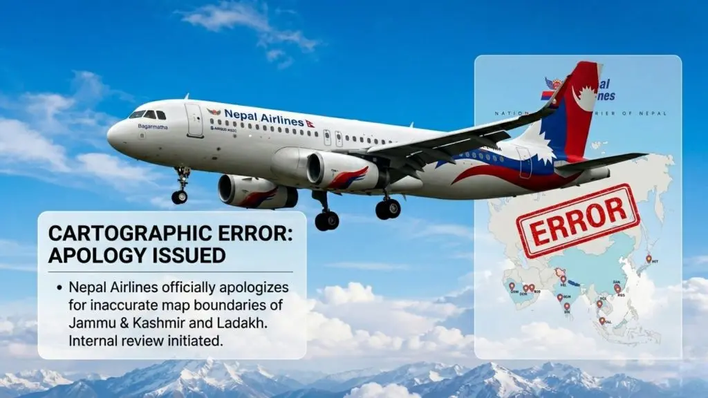
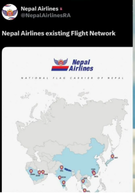
State-owned carrier Nepal Airlines has found itself in the center of a diplomatic and digital firestorm after its official social media channels shared a network map that incorrectly depicted the Indian Union Territories of Jammu and Kashmir and Ladakh as part of Pakistan.

The image sparked severe outrage among Indian netizens, prompting calls for action from authorities and a trending campaign on social media demanding a boycott of the airline.
Public Backlash and Social Media Outrage
The graphic, which was published on Wednesday (April 29, 2026), quickly caught the attention of social media users. Many criticized the airline for the territorial misrepresentation, questioning whether the move was deliberate or negligent.
As the criticism intensified, the hashtag #BoycottNepalAirlines began trending across X and Facebook. Public figures, including Bhojpuri actor-singer Khesarilal Yadav, also publicly condemned the depiction, alleging deliberate negligence. Users urged India’s Ministry of External Affairs (MEA) and the Ministry of Civil Aviation to raise a formal diplomatic protest over the issue.
Airline’s Response and Clarification
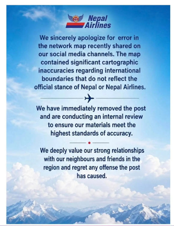
Recognizing the gravity of the backlash, Nepal Airlines pulled down the controversial post within hours. On Thursday (April 30, 2026), the airline issued a formal apology, citing “cartographic inaccuracies.”
“We sincerely apologize for the error in the network map recently shared on our social media channels. The map contained significant cartographic inaccuracies regarding international boundaries that do not reflect the official stance of Nepal or Nepal Airlines.”
Internal Review Underway
In its official statement, the carrier assured that corrective measures are being taken to prevent such incidents in the future. Airline officials noted that an internal investigation is currently underway to check editorial oversight.
A spokesperson for the airline clarified that the error was not a deliberate attempt to alter the map but rather an unintentional mistake where an incorrect base map was sourced online and used for the graphic.
Preserving Regional Ties
Beyond the technical error, Nepal Airlines was quick to emphasize the historical and cultural bonds shared between India and Nepal. The statement reaffirmed that the carrier highly values its strong relationships with its neighbors and deeply regrets any offense the erroneous post may have caused.
As the situation de-escalates, the incident serves as a stark reminder of the extreme sensitivity surrounding cartographic representations of territorial borders in South Asia.