Pune Outer Ring Road’s Western Stretch Now Visible on Google Maps as Construction Progresses
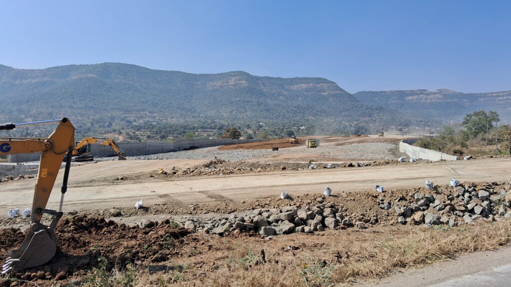

The western half of the under-construction Pune Outer Ring Road is now clearly visible on Google Maps and recent satellite imagery, offering one of the clearest signs yet of progress on the Maharashtra State Road Development Corporation’s (MSRDC) flagship infrastructure project.

The newly visible alignment stretches from the Mumbai-Pune Expressway near Urse to the Pune-Bengaluru Highway (NH-48) near Khed Shivapur. Large sections of the greenfield corridor can now be traced across Mulshi and Haveli talukas, reflecting the extensive earthwork, road formation and structural construction completed over the past several months.
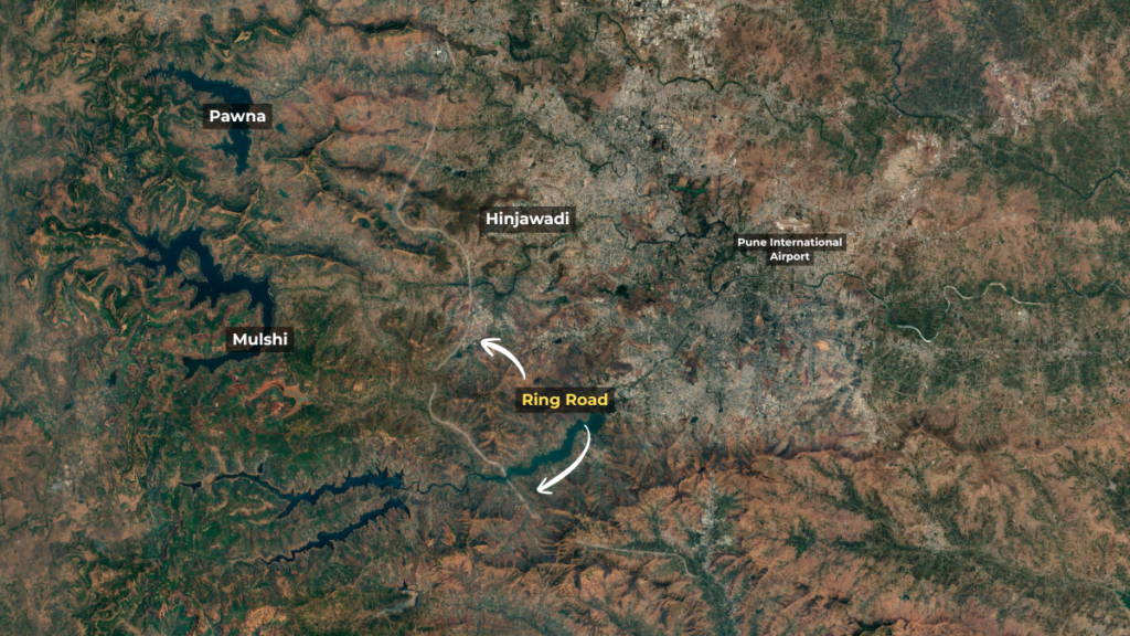
The western corridor, spanning about 65 km, has been divided into five construction packages. Megha Engineering is executing Package W1, Navayuga Engineering is handling Packages W2, W3 and W4, while GR Infraprojects is responsible for Package W5. Construction activity, including embankment work, bridge foundations, viaducts and tunnel works, is underway across all five packages, although progress varies between contractors.
Officials have earlier stated that the western section is being prioritised because it is expected to provide quicker relief to traffic entering Pune from the Mumbai-Pune Expressway and the Pune-Satara corridor. Once operational, the access-controlled expressway will allow heavy vehicles and long-distance traffic to bypass the city’s western edge instead of passing through congested stretches such as Chandni Chowk, Navale Bridge, Wakad and the Khed Shivapur toll plaza.
The Pune Outer Ring Road is among Maharashtra’s largest road infrastructure projects. Being developed by MSRDC, the project has an estimated cost of over ₹36,000 crore, including land acquisition. The complete corridor covers a footprint of around 173 km, with an access-controlled main loop of about 136.8 km designed for speeds of up to 120 kmph.
The expressway has been divided into 12 construction packages, with five on the western side and seven on the eastern alignment. The western section will connect Urse on the Mumbai-Pune Expressway to Khed Shivapur on NH-48 through Maval, Mulshi and Haveli, while the eastern section will complete the loop via Purandar, Theur, Lonikand, Chakan and Khed.
The project will eventually provide direct connectivity between six major national highways converging on Pune, helping divert freight traffic away from the city while reducing travel time for through vehicles. It also includes multiple interchanges, major bridges, viaducts and twin-tube tunnels through the Sahyadri hills.
Land acquisition for the project is largely complete, with MSRDC having secured nearly all the required land across more than 80 villages. Construction is progressing simultaneously on both halves of the ring road, although the western corridor is expected to be opened first in phases before the entire expressway is completed.
With the alignment now prominently visible on Google Maps, commuters can see the scale of the project taking shape on the ground. The updated imagery offers a visual indication of the steady progress being made on one of the Pune metropolitan region’s most important transport corridors, which is targeted for full completion by 2028.

Jayant Mahajan is a writer and contributor at PuneNow, covering the intersection of technology, climate action, and urban governance across Pune. With an extensive background in business management, digital transformation, and academia, Jayant brings real-world insight to local sustainability issues, from civic infrastructure to smart city data ethics. As an educator and founder of the Change Before Climate Change mission, he focuses on how Pune’s institutions and businesses can build future-ready, sustainable systems. Through his columns, Jayant bridges policy, technology, and practical action to help Punekars navigate a rapidly changing urban climate.