Maharashtra to Witness Increase in Rainfall Intensity as IMD Warns of Intense Rain, Storms and Disruptions Until May 27
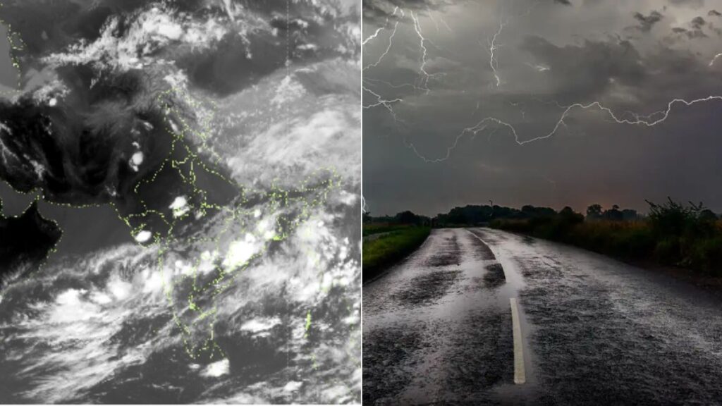

The India Meteorological Department (IMD) has issued a comprehensive weather alert for Maharashtra, forecasting a significant increase in rainfall activity across various regions over the next 6–7 days. This comes in the wake of developing weather systems over the Arabian Sea and a likely intensification into a depression by the evening of May 23, 2025.

Weather Systems Driving the Change
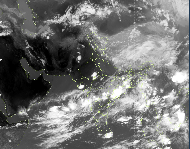
A low-pressure area currently lies over the East Central Arabian Sea, just off the South Konkan-Goa coast. This system is expected to move northwards and intensify into a depression. A trough from this cyclonic circulation extends up to North Telangana, influencing weather conditions across Maharashtra.
Rainfall Forecast Across Regions
- Konkan & Madhya Maharashtra:
Fairly widespread to widespread rainfall is expected, with heavy to very heavy rainfall at isolated locations from May 22 to 27. Isolated extremely heavy rainfall is also likely on May 22–23, especially over Konkan and the adjoining ghat areas of Madhya Maharashtra. - Madhya Maharashtra & Marathwada:
Scattered light to moderate rainfall, accompanied by thunderstorms, lightning, and gusty winds reaching speeds of 50–60 kmph, is expected from May 22 to 25.
Monsoon Progress Update
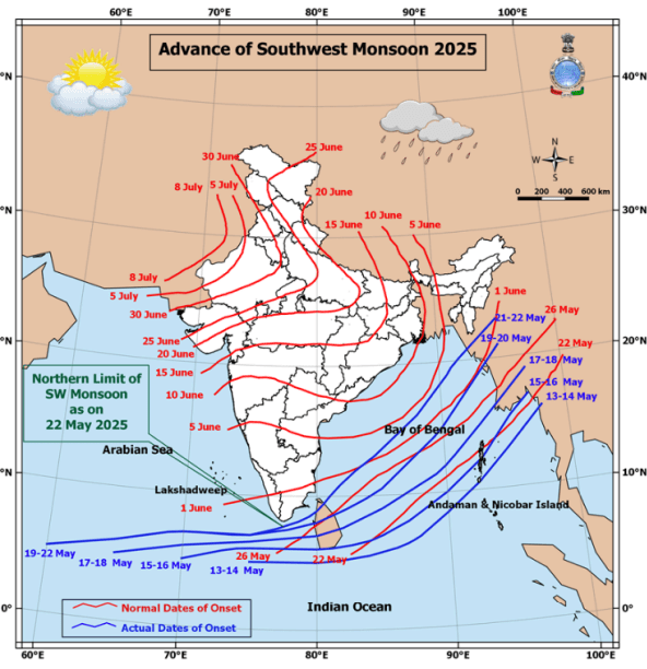
- The Northern Limit of Monsoon (NLM) has advanced significantly and now extends up to 23°N/95°E.
- IMD forecasts onset of monsoon over Kerala within the next 2–3 days.
- Conditions are also becoming favourable for further monsoon advancement over other southern and northeastern parts of India.
High Alert for Fishermen
- North Maharashtra Coast:
Squally weather with wind speeds of 35–45 kmph (gusting to 55 kmph) is likely on May 21. Between May 22 and 25, winds may intensify to 40–50 kmph (gusting to 60 kmph). - South Maharashtra–Goa Coast:
Similar conditions are forecasted from May 20–25, with dangerous sea conditions. - Critical Dates for Fishing Ban:
Fishing operations must be suspended from May 25 to 27 in the east-central and adjoining northeast Arabian Sea.
Fishermen already at sea are strongly advised to return by the afternoon of May 23.
Port and Coastal Warnings
- Ports from Bankot to Marmugao on the South Maharashtra-Goa coast must hoist Local Cautionary Signal No. III.
- Squally winds reaching speeds of 45–55 kmph (gusting to 65 kmph) are expected in these coastal areas.
Likely Impact
- Localized flooding and waterlogging in low-lying and urban areas.
- Disruption to road, rail, air, and ferry transport.
- Potential flash floods and riverine flooding in catchment areas.
- Possibility of landslides, rockfalls, and structural damage to weak buildings.
- Risk to horticulture and standing crops due to wind and inundation.
- Rough sea conditions with high tides and squalls along the coast.
- Danger from lightning and strong winds during thunderstorms.
Public and Farmer Advisory
- Avoid travel through flood-prone or waterlogged areas.
- Do not take shelter under trees during lightning.
- Disconnect electrical appliances during storms.
- Farmers should harvest mature crops immediately, provide support to fruit plants, and store harvested produce securely.
- Avoid chemical sprays or irrigation and ensure drainage in fields.
- Shelter livestock and avoid open-field work during lightning activity.
Citizens and local authorities are urged to stay alert and follow advisories issued by IMD, disaster management authorities, and local administrations.
For regular updates, visit: